Geotag photos on Mac · iPad · iPhoneYour camera knows when.
Your iPhone knows where.
Record a GPS track on your iPhone while you shoot. Later, point EasyGeotag at a folder of photos — it matches each frame to where you were standing and writes the coordinates into the file.
Recording is free, always. Five photos to try tagging, then one purchase unlocks all three apps.
Two halves of the same fact, stored in different places.
In the photograph
2026:08:06
08:04:00
EXIF puts the shutter time in the file. Every camera does this, and nothing else.
In your pocket
1.2811° N
103.8565° E
Your phone logged where you stood at 08:04:00 — on the Marina Bay waterfront promenade — to within a few metres.
Putting the two together by hand is easy enough for one photo. For six hundred — with a camera clock running four minutes fast, in a timezone your camera never recorded — it is an evening's work.
The whole workflow
Three steps, and you only do the first one on purpose.
-
01
Record
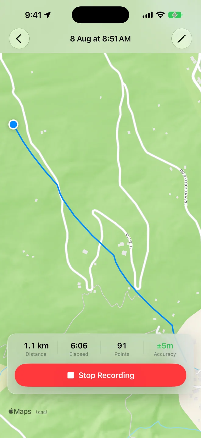
One tap on the iPhone starts a trip. Lock the phone, put it in your pocket, and shoot. Points are logged by distance rather than on a timer, avoiding redundant track points while you stay in one place.
Start it, stop it or ask how far you have gone — from Siri, or from a Shortcuts automation that fires when the Camera app opens. If you explore the live map while recording, Center Map returns to your latest location without resetting the zoom.
-
02
Match
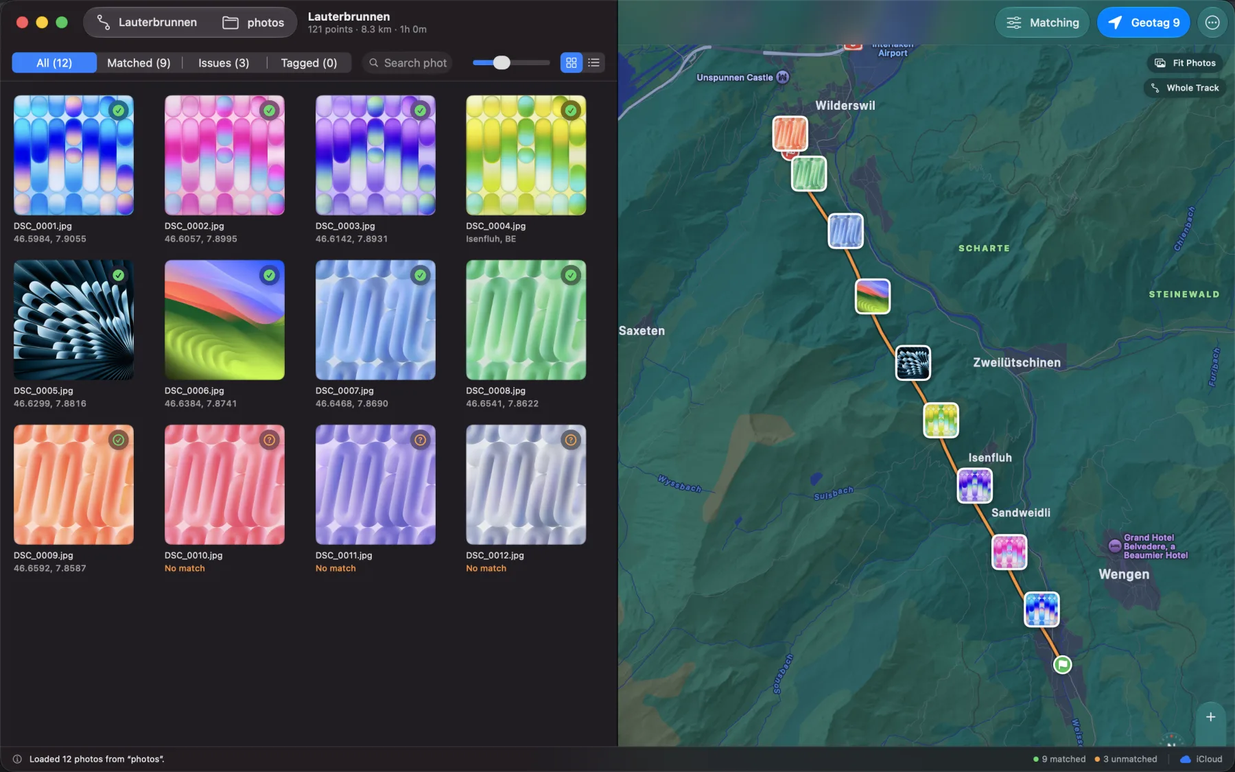
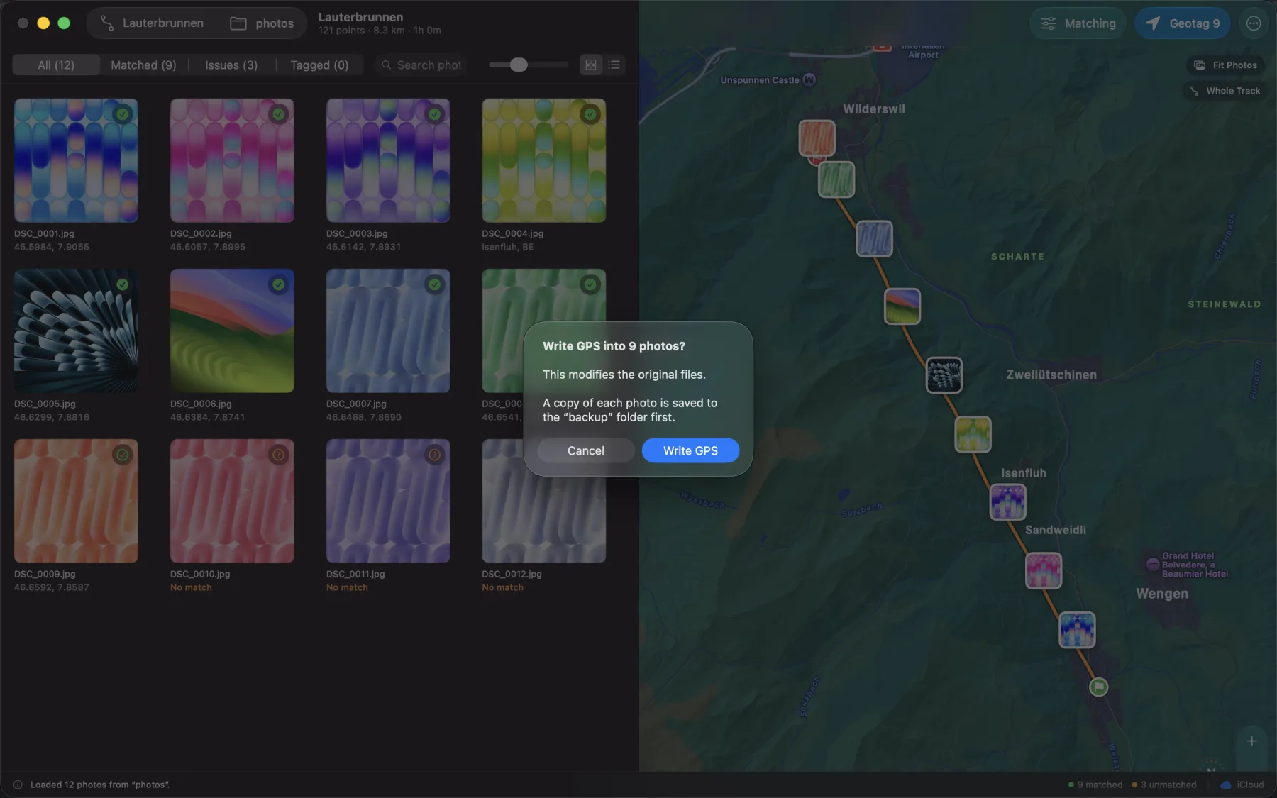
Open the folder on your Mac or iPad. Every photograph is placed against the track, and every one shows you how far it sat from the nearest real GPS fix — not just a pin, but how much to trust it.
Drag the folder straight onto the window if that is quicker. Positions interpolate between fixes, so a burst of frames does not collapse onto one coordinate.
-
03
Write
Press Geotag. Coordinates, altitude and the place name go into the files themselves — ready for Lightroom, Apple Photos, or wherever your work lives.
Files modified in place are copied to a backup folder first. Backups are on by default; sidecar-only RAW originals are never opened for writing.
Or skip step one
Already carry a GPS device?
Then you have done the recording already. On Mac or iPad, Open GPX File… accepts a standard GPX track from a Garmin watch, a handheld, an action camera, or other software. Select it from Recent Files to use the same photo-matching and metadata-writing workflow as an iPhone-recorded trip. How to geotag photos from a GPX file.
The last eight files you opened stay in that list, so a track you return to is one click away rather than a trip back through the file browser. On iPhone, open or share a GPX from Files to import it into Trips; duplicate routes open the existing trip.
One purchase
The phone records. The Mac and the iPad do the work.
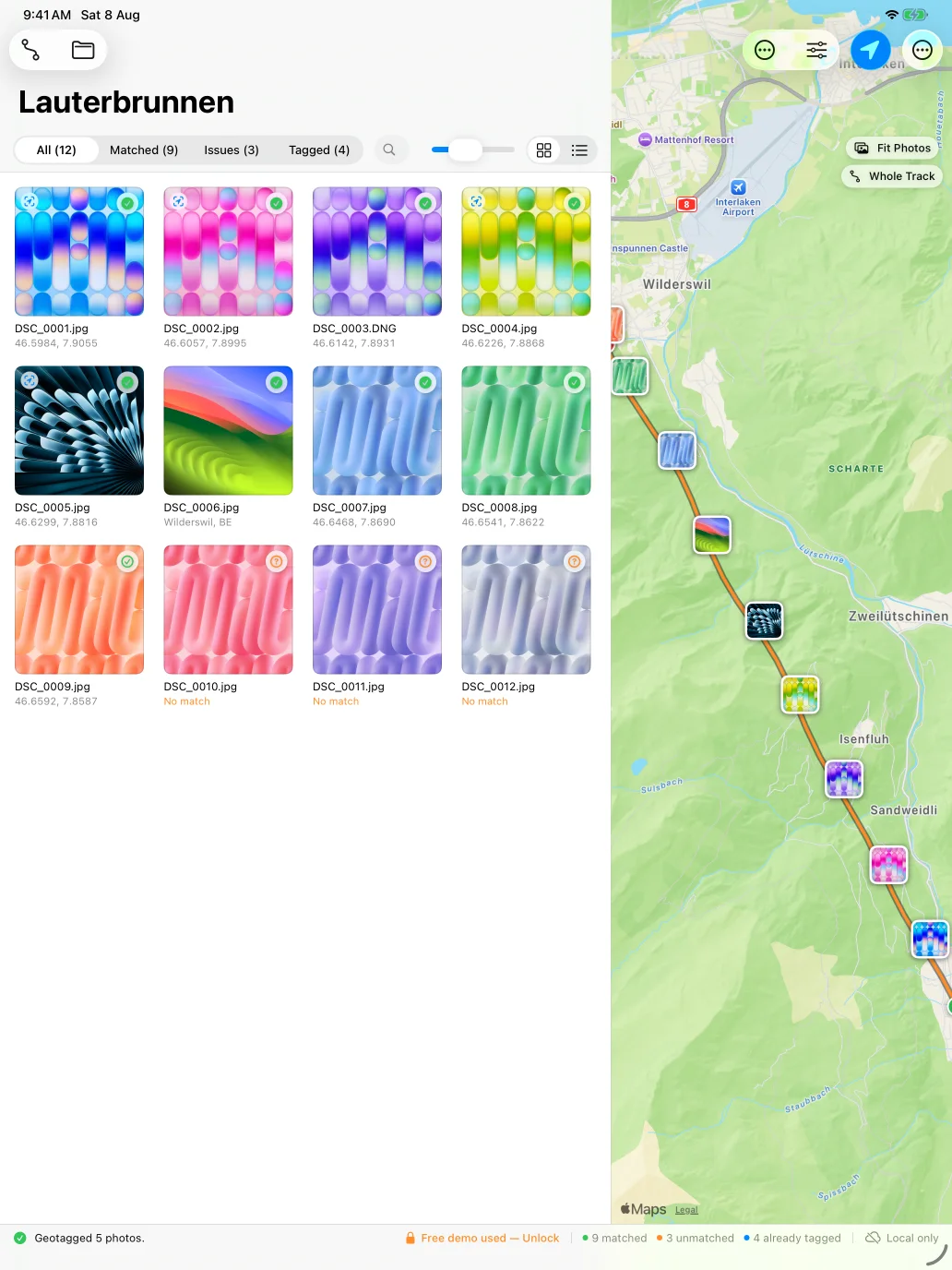
iPad is not a stretched-up phone app here — it runs the same workspace the Mac does. Pull a card straight into it and tag on the train home.
Find the frame
Search a folder of six hundred by filename, and read it as a grid of thumbnails or as a list when the names matter more than the pictures.
Tag all of it, or some of it
Select All, choose a range on Mac, or enter multi-select on iPad. Existing GPS is marked before writing and can be skipped automatically.
Drag it in
Drop a photo onto the map to place it, or drop a folder or GPX file onto the window to open it.
A trip library that stays useful
Find the shoot, then give it a name worth remembering.
Search recorded trips, group a long history by month or year, and rename any trip without breaking the GPX file behind it. On supported devices, the route itself can help you find a useful name.
Search and group
Filter by trip name and collapse older work into month or year groups, while the latest meaningful route stays easy to reach.
Rename the real file
Change a trip name from its card or map. EasyGeotag renames the matching GPX file too, so the library and Files never drift apart.
Three grounded choices
Suggest from Route offers up to three short, editable names rather than committing you to one. Pick one, change it, or ignore the whole set; only Save renames the trip.
Understands the journey
The route-naming pipeline distinguishes loops from point-to-point trips, adapts its evidence for longer routes and avoids cosmetic repeats of names already in your library.
Private by default
Route facts and name generation stay on device. Optional Apple Place Lookup progressively sends representative route samples to Apple’s geocoder for location-specific names; it is on by default, and raw coordinates never enter the model prompt.
Route-name suggestions require a supported Apple Intelligence device, supported language and OS 26 or later. Manual naming works everywhere.
Precision
Most wrong geotags are clock problems.
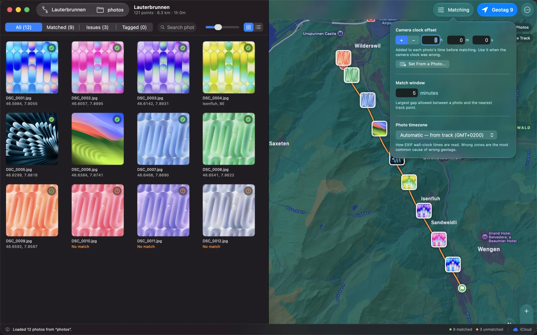
So the controls are about time, not about maps. Get the clock right and the coordinates follow. Why geotags come out wrong, and how to fix them.

Camera clock offset
Correct a drifting body to the exact second — or photograph a clock once and let EasyGeotag calculate the offset in the photo’s timezone.
Timezones that don't guess
Embedded camera timezone data stays authoritative in mixed-camera folders. The track or your chosen timezone fills only photos missing one.
Match confidence
Each frame shows how far it fell from the nearest recorded fix, so a shot taken in a tunnel never masquerades as certainty.
Interpolation
Positions are calculated between fixes rather than snapped to them — thirty frames in ten seconds get thirty coordinates.
Place it by hand
Nothing recorded for that frame? Drag the photograph onto the map and drop it where you were.
Indoors, and back out
When the signal goes, recording waits for movement instead of scattering noise across the track, and resumes the moment it returns.
Your recording threshold
Keep continuous distance logging, where movement must clear GPS uncertainty, or sample every 15 seconds to 5 minutes to trade route detail for battery life. Set the weakest GPS accuracy you will accept, with optional weak-signal status and notifications.
Map first, controls clear
Adjust the recording panel’s glass transparency while the Stop action stays fully opaque and unmistakable. Pan and zoom freely, then recenter without losing your chosen scale.
What actually gets written
Coordinates are not enough to find a photograph again.
Nobody searches their library for 1.2811° N, 103.8565° E. They search for Marina Bay. So the city, region and country go into the IPTC fields that Lightroom and Photos index — alongside the raw numbers.
JPEG & HEIC
Written in place through Apple's own ImageIO, on Mac and iPad alike. Capture dates and everything else in the file are left exactly as they were.
RAW on Mac
NEF, CR3, ARW, DNG and the rest, written directly into the file by ExifTool — bundled inside the app, nothing to install.
RAW on iPad
iPadOS cannot run ExifTool, so a RAW gets an XMP sidecar beside it instead. Lightroom, Camera Raw, Bridge and Capture One all read one, and your original file is never opened for writing.
That last difference is a real limitation of iPadOS, not a preference. The app tells you which of the two is about to happen before it writes a single byte. Existing XMP sidecars are left untouched by default; opt in to replace only GPS and location fields while ratings, keywords, develop settings and other metadata remain intact. On Mac, embedded XMP can be controlled separately for proprietary RAW files and DNG files. More on geotagging RAW photos.
Reversible, and private
It asks before it touches anything.
Every file modified in place is copied into a backup folder first when the default backup setting is enabled, and Restore Originals puts it back whenever you want. Sidecar-only RAW operations leave the original untouched; opted-in XMP updates preserve unrelated editing metadata. If you turn backups off, the confirmation says so before it writes. You confirm the write first, and the sheet tells you exactly how many files and what will happen to them.
Your photos, tracks and locations stay on your own devices and in your own iCloud account. A minimal server-side counter keeps the five-photo demo to five photos per Apple Account; it receives no photos, filenames or locations. There is no account to create, analytics, advertising or tracking.
Tag five photos free.
Then one purchase unlocks every app — Mac, iPad and iPhone — once, and shareable with your family. Recording was never limited in the first place.
Requires macOS 15, iPadOS 18 or iOS 18.